Brighton Shoreham Airport
Brighton City Airport is located in Shoreham-by-Sea, 5 miles to the east of Worthing or 7 miles to the west of Brighton, on the south coast of England. It is easy to get to the airport by A27 road, and there is also a central railway station 1.5 miles from the Terminal building. Besides, buses and taxi services are available too.
Working Hours
The airport operates daily:
Monday-Friday: 08.00-18.00
Saturday-Sunday: 09.00-18.00
Hummingbird Restaurant is open for takeaway services only due to the lockdown restrictions from Monday to Friday between 08.30 and 14.30 and at weekends between 09.00 and 14.30.
The airport complies with the Covid-19 mitigation measures, so visitors are required to wear face coverings and move within one direction: enter from the southside and exit through the airport’s eastern gate.

Brighton Shoreham Aiport Building in Art Deco Style
Arrivals and Departures
Arrivals and departures may be also followed online: https://flybrighton.com/arrivals-departures/
Contacts and Location
Official website: https://flybrighton.com/
Phone: 01273 467376
E-mail: reception@flybrighton.com
Address:
Brighton City Airport
The Terminal Building
Cecil Pashley Way
West Sussex BN43 5FF
Coordinates: 50°50'8.978" N -0°17'41.918" E
Local towns
Shoreham-by-Sea — 1 mile east of airfield.
Brighton — 7 miles east of airfield.
Worthing — 5 miles west of airfield.
Railway station
Nearest station: Shoreham-by-Sea.
Trains to London, Brighton, Worthing, Southampton, Portsmouth, Chichester.
Airport taxi services
CarCabs: +44 (0) 1273 414141
Accommodation and car hire services
Tel. +44 (0) 1273 467 374
Tel. +44 (0) 1273 467 375
Fax. +44 (0) 1273 467 350
Live Webcam
Watch online the takeoff and landing on the Brighton City Airport’s longest runway 02.

Live online stream from Brighton City Airport
Axis Q1765-LE network camera connected to StreamDays stream service and receives over 30,000 hits a month from all over the world.
Information for Pilots
Full information about Brighton City Airport may be obtained following the link: NAT e-AIP.
Then click “AD 2 AERODROMES” in Part 3 on the left, and scroll down to click “EGKA SHOREHAM”.
Air Traffic Control
Tel. +44 (0) 844 225 4202
Fax. +44 (0) 1273 467 370
AFTN: EGKAZTZX
ATIS (Automated weather information): 0844 225 4201
Email: airtraffic@flybrighton.com
PPR Requirements
All visiting aircraft should inform the following things in advance via phone or email:
- ETA
- Callsign/registration
- Aircraft type
- Departure airfield.
- POB
Aerodrome Manual for Brighton City Airport is available on application from reception at flybrighton.com.
Pilots have to double-check the current NOTAM and AIP to get up-to-date information directly before flying out.
Pilots wishing to fly in or out with dogs should settle with the airport’s fire crew before the flight.
Flight crew phone number: 01273 467395.
It is also required to notify about all General Aviation flights inbound to the United Kingdom and outbound flights to the Republic of Ireland, Northern Ireland, Channel Islands, Isle of Man, and any destination outside the European Union through submitting the General Aviation Report.
All the necessary files of general aviation reports may be downloaded here:
GENERAL AVIATION REPORT and General Aviation Report (GAR).
Pilots and carriers are recommended to download GAR-form, fill it out electronically, and send its copy by email to the national coordination unit to be then passed on to border divisions or police.
Historical Background
It was 1903 when the Wright brothers, Orville and Wilbur, gave a try to the first-ever flight on their Wright Flyer machine. Though it lasted 12 seconds and 120 feet, history was shaped forever. The era of the airplane started from then on.
The industry of airline services was undergoing such rapid development that airports around the world began to be constructed in large numbers during the decade after the first successful flight.
No wonder that there has been a continuous debate on which of them should be deemed the first one.
At present, College Park established by Wilbur Wright in 1909 (Maryland, USA) is generally accepted as the oldest continually operated airport in the world.
Opened in January 1911, Hamburg Airport is also referred to as the world’s oldest commercial airport in operation.
The oldest airport in Britain, Brighton City Airport (also called Brighton Shoreham Airport) opened on June 20, 1911, is sometimes regarded as the oldest in the world too.
The first flight in Shoreham-by-Sea took place in 1910 and was piloted by Harold H. Piffard, one of the British aviation pioneers, a talented artist, and an illustrator.
According to the legend, the primary aim was to win the crate of champagne from the pub's owner, Alfred Evans of the Sussex Pad Inn.
If Piffard could ever fly the length of the field where the airplane was housed, he would get the crate. And he proved able to.
Very often, 1910 is thought to be the year of Shoreham foundation, not the date of the official terminal opening.
Having worked on the tea plantation in India, and showed a natural talent in an acrobatic troupe in England later, Harold Piffard unexpectedly turned his attention to aviation. In his sheer excitement of planes, the Aviator’s Finance Company Limited was incorporated.
Together with a friend and company co-owner, George Wingfield, they leased some land with a hangar in Shoreham-by-Sea to practise aeronautics and try their air vehicles. As time went on, the territory where trial flights took place became the Shoreham Airport.
Aerodrome in Shoreham-by-Sea
The Shoreham-by-Sea territory has been used as an aerodrome since 1910.
Apart from Harold H. Piffard who conducted his engineering experiments and trials of air vehicles there, the other outstanding aviators of that time used to fly the Shoreham sky: Alliott Verdon Roe (the founder of the Avro company) and John Alcock (the pioneer of the non-stop flights across the Atlantic).
Competitions and festivals were held too. In 1911, Shoreham Aerodrome hosted the Circuit of Britain and Circuit of Europe air races.
On July 4, 1911, Shoreham became the dispatching point for the first air freight transportation in the world when Horatio Barber piloted his Valkyrie monoplane to deliver the consignment of Osram lamps to the neighbouring Hove.
Before the beginning of World War I, Shoreham Aerodrome was the place where renowned pioneers of British aviation, Cecil and Eric Pashley, created a flight training school and collaborated on aircraft engineering.
In 1914, World War I began and Shoreham Aerodrome was requisitioned by the military and used as the training base for the Royal Flying Corps. And exactly from here the first flight of the British military aviation was bound for taking part in the English Channel battles.
The RFC squadron was equipped with Maurice Farman Longhorn biplanes that could develop the maximum speed of 59 mph. It was unprecedented progress.
Newly-qualified pilots were sent from Shoreham to the western front line shortly after completing the course on weapon direction and air pilotage.
Eric Pashley who also joined the military aviation was killed in action in 1917.
At that time, Cecil Pashley was training the pilots, and when Shoreham Southern Aero Club was established in 1926, he continued his teaching.
Cecil was a flight instructor during the entire World War I and taught piloting more people than anybody else could in the 20th century. Cecil Pashley died aged 77 having logged around 20,000 hours during his long life.
He was a notable aviator dedicated to developing the industry since its origins and teaching others through the prism of his knowledge and experience.
A road and a bus at Shoreham-by-Sea have been named after Cecil Pashley.
When the war ended, the newly-formed Canadian Air Force moved to Shoreham from Upper Heyford to spend time teaching, learning, and trying some of the 65 captured German aircraft that were being stored at the aerodrome.
Life there was on hold till December 1921.
The flights at Shoreham were revived at the end of 1925 when Cecil Pashley in cooperation with the Miles brothers incorporated the Gnat Aero Company Ltd.
The aerodrome was actively functioning during the second half of the 1920s: aviation was developing along with hosting various festivals and aeroclub meetings.
Becoming an Airport
In 1928, Shoreham started being transformed into an airport. Residents of Brighton, Hove, and Worthing bought out the territory and tasked a famous aviation promoter, Sir Alan Cobham who also took part in architecting the Liverpool John Lennon Airport, with this transformation.
Investors put high hopes on aviation as the promising economic sector during the 1920s-1930s and ploughed into it.
Construction of the Shoreham Airport Terminal began in 1934.
This prominent Art Deco landmark was designed by R Stavers Hessell Tiltman, a successful architect of the 1930s who also designed Belfast-Harbour and Leeds-Bradford airports in 1939.
However, the latter one has already lost its historical identity.
The Terminal was built by James Bodie Ltd during 1934-1935 with £55,000 as the allocated funds.
The building was created using cubic, orbicular, and curvilinear forms in the streamlined Art Deco Moderne style, quite popular in the 1930s - 1940s.

Shoreham airport in 1930s
Wooden hangars, which had been used before, were rebuilt into a concrete-and-steel construction. The original steel frame had two wings and an entire incline on western and eastern walls.
The roof was constructed with steel angular fragments whereas the wall consisted of glass and concrete, and the floor was based on reinforced-concrete slabs.
Two entrance doors opened to the northwest.
On June 13, 1936, this sophisticated Art Deco Terminal building was officially opened by the mayors of Brighton, Hove, and Worthing.
The building is preserved in its original form and is still open to the public these days. Besides, the Terminal along with the hangar has been listed as the special architectural landmark under the Planning Act 1990.
The number of flights to and from Shoreham increased greatly after it was transformed into the airport.
Bristol, Cardiff, Liverpool, Manchester, Jersey, Le Touquet, Deauville, and many others were among the destination cities.
Such companies as Channel Air Ferries, Railway Air Services, and Jersey Airways began using the airport for their flights.
It took two years to get the regular passenger services going between the Sussex coast and other remote destinations.
The sky above Shoreham continued to be the air show venue that gathered a lot of celebrities.
For instance, the first female aviator, Amy Johnson, who flew solo from London to Australia stopped off there in 1930.
A prominent pilot Charles Lindbergh famous for his solo piloting over the Atlantic in 1927 was among notable guests too.
Shoreham during World War II
Brighton City Airport would have thrived if World War II had not started.
In 1937, Shoreham became the base for the Royal Flying Corps Volunteer Reserve preparation.
Later, it substituted the Croydon Airport (London) and became the main international civil airport of Great Britain, but not for a long time.
Such airline companies as Sabena, DDL, KLM, and the British Airways predecessor, Imperial Airways, used to have flights from there to Copenhagen, Amsterdam, Malme, and Brussels.
In May 1940, the airport’s role changed again: 225 Squadron based there to patrol the borders.
Shoreham was also the emergency landing ground for the damaged aircraft and 96 Fighter Squadron.
In 1941, 277 Air Sea Rescue Squadron was based there.
The hangar was damaged during bombarding, but, fortunately, its frame was not destroyed. Then some repairs were carried out and the operational use continued. Capital repairs at Shoreham took place in 1950.
Though the airport had been targeted by air bombardment several times, the terminal building remained undamaged.
Shoreham was the place where the legendary Operation Jubilee (the raid on Dieppe) of 1942 was planned.
During the Normandy Landings of 1944 (known as D-Day), the airport was hosting the newly-hatched French Fighter squadron.
Post-War Period
When World War II ended, Shoreham Airport was slowly rebuilt. In 1946, civil flights were restored.
In the middle of 1951, Fred Miles and his brother George came back to organise aircraft manufacturing.
There was a recession of the British aircraft manufacturing industry till the end of the decade, and many old and known firms were incorporated into the British Aircraft Corporation.
Small firms like FG Miles Ltd needed allies and partners, so the newly-formed Beagle took them over.
Fred Miles repaired Shoreham Airport, but it was not necessary for conducting business.
Shoreham became the place where aircraft components were manufactured, and the airport itself ceased to function for some time.
In 1962, FG Miles Ltd was taken over by Auster under the name Beagle Aircraft Ltd. Since then, the hangar was transformed into a workshop for machines for some time.
Beagle Aircraft Ltd manufactured aircraft that took part in air racing and even won top awards.
However, American manufacturers gradually froze them out, and in 1970, the company was dissolved.
In 1971, Shoreham was handed back to local authorities as the city airport.
Airport Revival
Local communities of Brighton, Hove, and Worthing jointly managed Shoreham till 1971, but their alliance did not include the Shoreham-by-Sea community.
That entailed several confrontations, which frequently harmed the airport.
For example, the grass runway was not changed into a harder coating for a long time, even though it was not suitable for utilising, especially during adverse weather conditions.
It seemed logical that grass became slippery because of rains, so accidents could happen.
However, it took a decade to deal with the issue and take a range of other measures.
The paved runway was built in 1981. Besides, many plans on airport extension were developed during that time to check how convenient its point of departure was for short-distance trips.
In 1982, the airport was relaunched with a plan of an immediate and regular increase of flights focused on passenger services and general aviation.
That revived schedule of passenger transportation existed till the end of the 1980s when the recession began.
The 2000s
The airport was becoming more and more burdened with debts, and thus, massive investments were critical.
Several tenants did their best in attempts to retain the historical and architectural unity of Shoreham.
In June 2006, one of the co-owners, Erinaceous Group, claimed that the debts had reached £4 billion. Then the local authority sold the airport on a 150-year lease.
Albemarle Shoreham Airport Limited bought out the shares of Erinaceous Group in 2006 and announced they were going to renew the airport.
On May 2, 2014, Brighton City Airport Company redeemed the airport from Albemarle Shoreham Airport Limited, having united it within one owner.
Now the official name is Brighton City Airport, even though it is commonly known as Shoreham Airport.
Air travel was restored straightway, and the airport was supposed to increase the number and improve the quality of commercial flights to the nearby costs, Brighton and Hove in particular.
RAFA Shoreham Airshow
A year after the airport got its new name and a new life, it ended up in the news of all newspapers and TV channels.
The reason was not optimistic though.
The traditional Shoreham Airshow used to be a regularly held spectacle by the Royal Air Forces Association and had gathered viewers from around the world for 25 years.
On August 25, 2015, a Hawker Hunter aircraft that participated in the airshow crashed on the A-27 road near the Brighton City Airport.
As a result, eleven people died.
The show has not been held since that time.
Current time
Now Brighton City Airport (EGKA), also known as Shoreham, is commonly used for privately owned light aircraft of various flying schools and privately-owned airplanes in general.
It offers a range of breathtaking flights along the southern coast of England.
There are approximately 30 enterprises including SkySouth airline, different flying schools, small privately-owned aircraft, and firms of commercial transportation services that operate on the airport’s territory.
It is also possible to hire a helicopter or a private airplane for an important event or a business meeting.
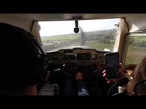
One can also make a childhood dream come true getting the piloting experience over magnificent green hills of the south-west and South Downs National Park.
Brighton City is a popular aerodrome for leisure and training. It is a perfect port for small aircraft that may be exploited within the 900-mile distance embracing numerous destinations around Europe.
This is the oldest British airport that combines modern runways, lighting, fuelling systems, and air traffic control.
There are the passenger lounge and reception area, a restaurant, a bar, meeting and conference rooms inside the terminal.
The airport also offers official guided tours, viewing areas, places for picnics, and parking. Besides, there is the required customs and immigration services list available.
Artistic Value and Atmosphere
Brighton City Airport is a cosy and small setting in comparison with modern ones. Here is no vastness, haste, and pompousness.
No endless stores and duty-free shops can be found after entering the main door, there is just a direct departure gate to the plane waiting at the aerodrome.
Slowing down there, one will be transferred to the times of simple understanding of how passengers, planes, and the building, lost in the process of globalisation, were interconnected.
Almost everything looks like it used to be in the 1930s.
The terminal building has barely changed if not to consider several reconstruction repairs and the control tower, built later southward of the original one.
An observing room, that is a small glass framework on the top of the control tower, has been also well preserved as well as the majority of lighting fixtures, the original gallery on the ground floor, and the main window design over the front entrance.
Despite reconstruction and modification after the damage caused by World War II, the main structure and form of the 1930s hangar have remained in their original state.
Being built in the 1930s, the airport stands out by its streamlined geometrical appearance and stylish modern interior together with loads of original and reconstructed Art Deco elements that range from ceiling decorations to light switches.
The Terminal opens the way to the lively airfield, and then - to an impressive Gothic-style Lancing College Chapel situated among the hills of the South Downs National Park.
Over time, this well-preserved Art Deco terminal building has become immensely popular in cinematography.
Shoreham may be seen in many films and TV series, including the Poirot episodes, Oh! What a Lovely War movie.
In 2005, the Shoreham Airport was depicted in The Da Vinci Code as the Le Bourget Airport in Paris, and as the Viennese airport in Woman in Gold.
In summer 2015, Brighton City Airport hosted the inaugural Wild Life Festival featuring Rudimental and Mark Ronson, which received the “Best New Festival” award.
If you like Streamline Moderne architecture, one of the places where you can fly from Shoreham can be Liverpool John Lennon Airport.
Its terminal building was opened three years after Shoreham in 1939.
Shoreham Airport is not only the place where movies are directed but also the source of inspiration for authors.
Peter C. Brown, an aviation historian, in his book, describes the history of this very centre of early British aviation.
Business Cooperation
Now Brighton City Airport cooperates with the following businesses:
- A2B Helicopter Maintenance
- Aardvark Engineering Ltd
- Aero AC
- AETS Ltd
- AIG
- A Greener Alternative
- A J Waite - T/A Landairmarine
- Acoustic Associates Sussex Ltd
- Advance Helicopters Ltd
- Air Pilot Publishing Ltd
- Apollo Aircraft Maintenance
- Asset-Pro Ltd
- Astaris IT & Marketing
- ATG Autotuning
- BlueSky Business Centre (Shoreham) Ltd
- Bonner Engineering
- Brighton Aviation
- Brighton City Airport Visitor Centre
- Brighton City Airport Reception
- Brighton & Hove Radio Cabs
- Claimserve Ltd
- Colin Cleaver
- Coast Dyslexia
- Commander Black
- Concierge Wealth Management Ltd
- Cox Powertrain Ltd
- Eastern Atlantic Helicopters
- Flight Calibration Services Ltd
- Flight Performance Training
- FTA Global
- Gochers Laundry Ltd
- GSM Activate
- H I T Training
- JetSpace Ltd
- Jet Flight Training Ltd
- John and Ginger Ltd
- K B Aviation
- London Helicopter Charters Ltd
- Max Wax Fleet Ltd
- Marine and Aviation Electronics Ltd
- Medical Device Treatment Ltd
- Northbrook Metropolitan College
- PerryAir Flying School
- Pooley Sword Ltd
- Rapitrans Ltd
- Remote Visual Inspections Ltd
- Ricardo UK Ltd
- Shoreham Helicopters
- South Coast Avionics Ltd
- South Coast Flying Club
- The Hummingbird Restaurant
- Transair Flight Equipment
- Transport Command Ltd
- Vanworx Ltd
- Vibratechniques Ltd
- Virtual Aerospace Ltd
- The Virtual Doctors.org
- Visitor Centre
- Wave Business Applications Ltd
A temporary lease of offices with a stunning airfield view is possible as well.


